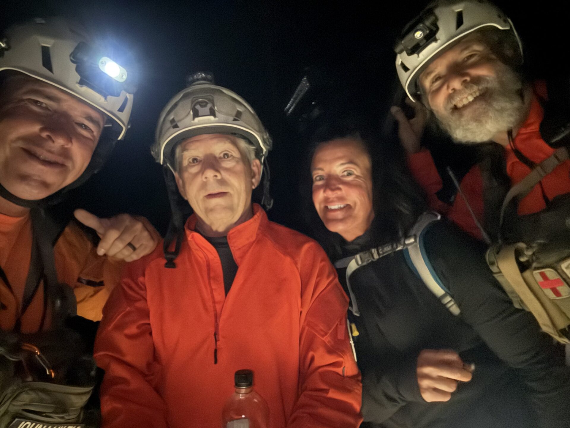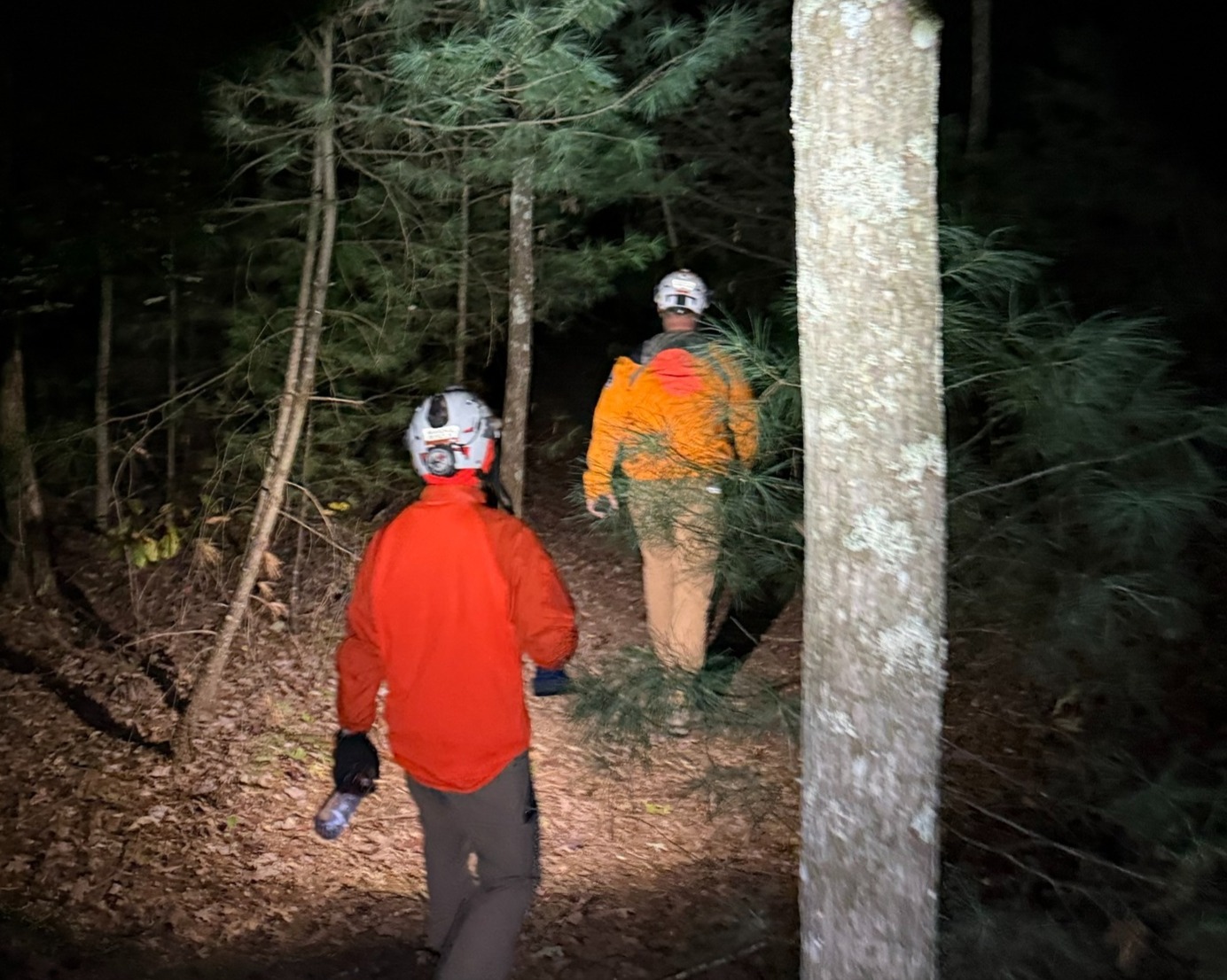
On a brisk October evening, WCSART received a 911 call for a lost hiker who had been on the trails for nearly 5 hours. Team members sent a locator link to the female hiker that identified her location on a cliff line above the Sheltowee Trace and Gladie Creek.
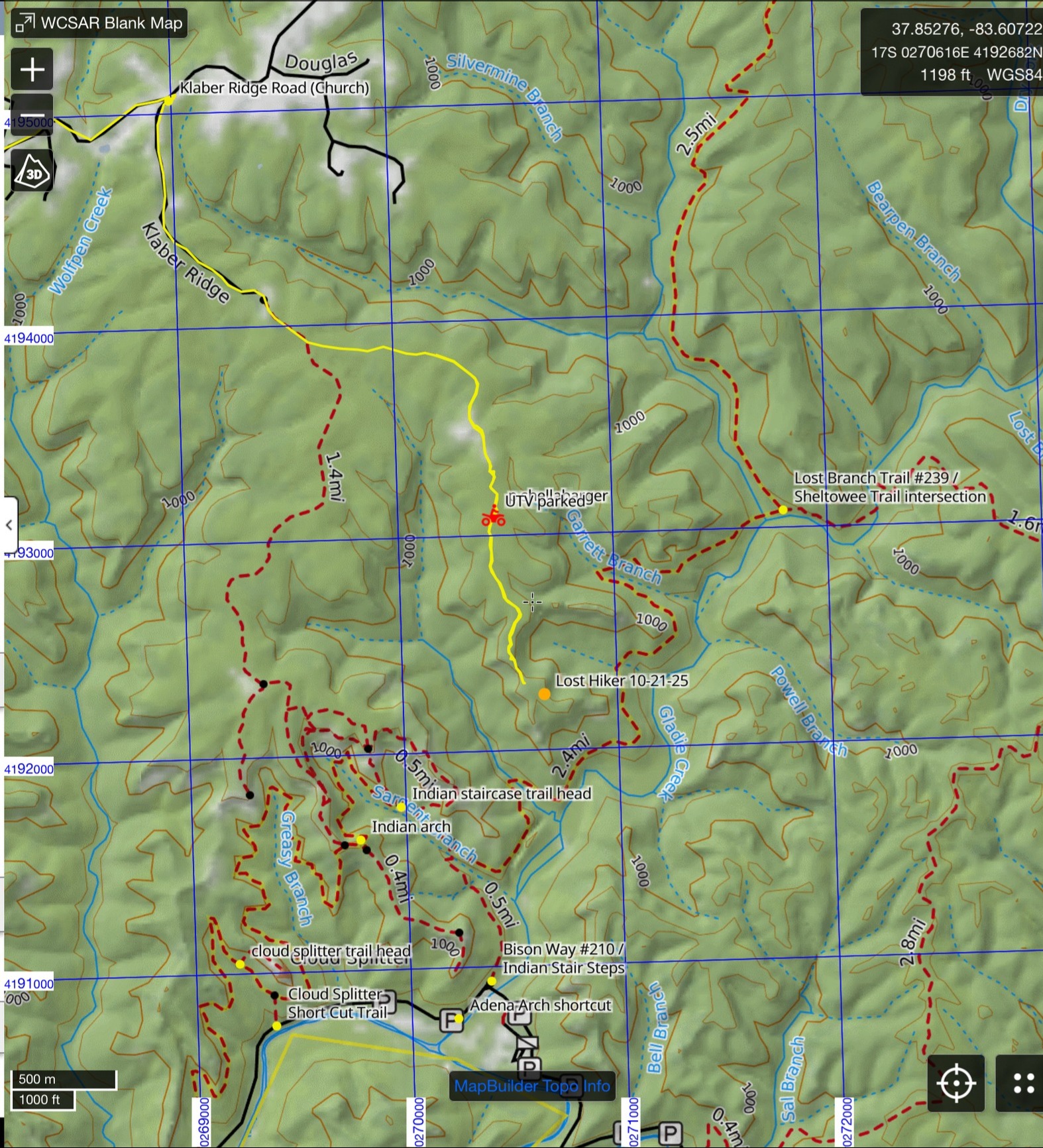
It was determined that the quickest and safest way to access her location was to enter along Klaber Ridge, via UTV and then hike in approximately one mile to her location. We are happy to report that the hiker was located in good spirits, uninjured and extremely happy to see WCSART, as darkness had fallen and she was not prepared to be out overnight in the rapidly dropping temperatures.
This was the second call over the past 12 months for a lost hiker at nearly this exact location. The hiker wasn’t able to provide much information on how she ended up at this location other than noting she had turned left on the Sheltowee at the Bison Way/Sheltowee Intersection. She didn’t appear to have been off trail (bushwhacking) as her clothes and shoes were not indicative of off trail travel
The rescue was a reminder to prepare in advance, bring essentials, especially navigation tools like Gaia and CalTopo, and that it is always more danger to go by yourself. A good practice is to text a friend or family member before entering the woods so that authorities can be alerted if you get into trouble.